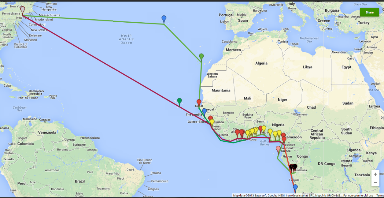
I’m doing some research on Hughes’ trip to West Africa, which is often considered a formative moment for Hughes’ politics and understanding of race. As a visual thinker, I was having trouble keeping track of exactly where Hughes went while employed as a mess boy on the West Hesseltine, a cargo and passenger ship. Using the ports and dates that Arnold Rampersand gives in his biography of Hughes, I plotted out the points on Google maps. The green lines show the voyage out, and the red lines show the return trip. The pin colors show the imperial power that controlled the ports he passed through. Portuguese territories are marked with blue pins, Spanish with green, French with red, British with yellow, and Belgian with black. I may have made an error here or there, but I thought it was interesting and worth sharing.

Click here to view the map in Google.
Looking at this map, one thing that stands out to me is the impressive cross section of colonialism that Hughes encountered. He passed through the colonial territories of no fewer than five empires–British, French, Portuguese, Spanish, and Belgian–an experience that opened his eyes to the violence and exploitation of colonialism. Describing his first impressions of Africa in his autobiography, Hughes recalls “A long, sandy coast-line, gleaming in the sun. Palm trees sky-tall. Rivers darkening the sea’s edge with the loam of their deltas. People, black and beautiful as the night. The bare, pointed breasts of women in the market places. The rippling muscles of men loading palm oil and cocoa beans and mahogany on ships from the white man’s world, for that was why our ship was there–to carry away the treasures of Africa. We brought machinery and tools, canned goods, and Hollywood films. We took away riches out of the earth, loaded by human hands” (101-102).
